Core Principle 1: Watersheds are natural systems that we can work with
Delineating the Watershed
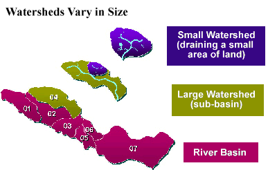
A watershed is simply the land that water flows across or through on its way to a common stream, river, or lake. A watershed can be very large (e.g. draining thousands of square miles to a major river or lake or the ocean), or very small, such as a 20-acre watershed that drains to a pond. A small watershed that nests inside of a larger watershed is sometimes referred to as a subwatershed.
You can delineate a watershed (or many watersheds) on a USGS topographic (topo) map using two important map symbols: the blue hydrographic lines symbolizing water and the brown elevation contour lines indicating areas of equal height above sea level. Since water flows downhill from higher elevations to a common body of water, to delineate the watershed boundary for a particular place on a stream or lake, you will need to draw a line along the ridgetops connecting the highest elevation points surrounding the lake or stream. Delineating the ridgeline on a topo map is actually more challenging than you might first imagine!
Fortunately, there are maps and computer databases you can turn to that have watershed boundaries already delineated--particularly for larger basins and watersheds. One popular source is Surf Your Watershed website. So let's do some surfing - the following images simulate a visit to the Surf Your Watershed website. After you enter this website, one way to find the watershed boundary for the area you're interested in is to click on the appropriate state on the US map.
Once the state map appears, you can click on the area of the state you're interested in.
What pops up is the watershed boundary with major streams, lakes and cities in the watershed highlighted.
Find a blue line anywhere on the map and follow it upstream or downstream; soon you hit a junction with another stream called a confluence. The lowest junction is called the mouth or outlet of the watershed.
Follow one of the blue lines until it ends near a ridge top marking the watershed boundary. Now, let's explore what you find within the watershed boundary. The places where surface waters first begin flowing are called headwaters. Some experts like to categorize the hydrography or water bodies within a watershed by a classification system referred to as stream order. For example, when a stream first begins, it is called a first order stream. When two first-order streams join, the water below the junction is called a second order stream, etc. In this classification system, the next higher order stream is formed when two of the immediately lower order streams have joined. We often talk about three management zones when discussing watershed management--the waterbody, riparian, and upland zones. Waterbody is a term that includes any stream, river, pond, lake, estuary or ocean. The riparian zone is defined as the non-cultivated, vegetated area between the waterbody edge and the upland area. Riparian means "of the river" and the riparian zone is intimately connected with the waterbody. This zone often includes, but is not limited to, wetlands bordering waterbodies. The upland area is not an exact term, but usually is defined as the land above a high water mark (e.g. 100 year flood plain).