


Step 2: Characterize Your Watershed (cont.)
Finding the Right DataYour data collection effort should begin with your stakeholders. Stakeholders might know of a wide variety of existing data directly related to the issues you will be focusing on as you develop your plan. For example, if the stakeholders identified development pressures as a concern, perhaps someone from your town’s planning department is an involved stakeholder. They will likely be able to help you collect information on land use patterns, building permits, and current zoning practices. If they have identified the protection of wetlands as a goal, you should identify the wetlands in the watershed and any current protection strategies in place.
Although stakeholders can provide some data, much of the data you need for characterizing your watershed might have already been partially compiled and summarized in existing reports, including the following:
- 305(b) report (as part of the Integrated Report)—summarizes designated use support status for waters in the state.
- 303(d) lists (as part of the Integrated Report)—identify waters not meeting water quality standards.
- EPA’s Assessment Database (ADB)—includes data used in 305(b) and 303(d) assessments.
- ATTAINS—this is an EPA maintained database that includes locations of 303(d)-listed waterbodies and provides downloadable geographic information system (GIS) coverages.
- TMDL reports.
- Source water assessments.
- CWA section 319 Watershed Plans.
- Clean Lake Plans (CWA section 314).
- Federal agencies
 —USGS, USFWS, USFS, BLM, USACE
 - State agencies—Water, fish and game, forest, agriculture
- Local agencies—Water/wastewater, health, planning and zoning, etc.
- Colleges & universities—Special studies, class projects
- Watershed groups—Volunteer monitoring programs, local knowledge
- Envirofacts: http://www.epa.gov/enviro/
- STORET: http://www.epa.gov/storet
- WQX: http://www.epa.gov/storet/wqx/
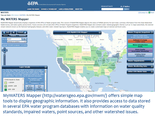
- MyWATERS Mapper: http://watersgeo.epa.gov/mwm/
- ENVIROMapper: http://www.epa.gov/emefdata/em4ef.home
- GRTS: https://ofmpub.epa.gov/apex/grts/f?p=110:95:0:NO:::
- ICIS: https://www.epa.gov/enviro/icis-model
- ECOTOX: www.epa.gov/ecotox
- BASINS: http://water.epa.gov/scitech/datait/models/basins/index.cfm
- Cleanups in My Community: http://www.epa.gov/cimc
- Watershed Plan Builder: https://www.epa.gov/waterdata/watershed-plan-builder
- Superfund Site Information: https://www.epa.gov/superfund/search-superfund-sites-where-you-live
- The following links below exit EPA
- Water Quality Portal: http://www.waterqualitydata.us
- NWIS: http://waterdata.usgs.gov/nwis
- International Stormwater BMP Database: http://www.bmpdatabase.org
- GeoData.gov: http://geo.data.gov/geoportal/