1. Pre-harvest Planning BMPs (continued)
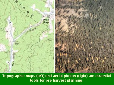
In preparing a pre-harvest plan, several resources are available and should be used including topographic maps, aerial photographs, and soil surveys along with field trips to determine site conditions. Many of these information sources are now available in digital format, or can be scanned. Global positioning systems (GPS) are useful in the field trips to note the location of important features. Field data geolocated with a GPS can be combined with electronic maps in a PC-based mapping system or Geographic Information System. In this manner, the new information revealed by field visits and aerial photo analysis can vastly improve the mapped information used for harvest planning.