
Grantee Research Project Results
2011 Progress Report: Framework for Context-Sensitive Spatially- and Temporally-Resolved Onroad Mobile Source Emission Inventories
EPA Grant Number: R834550Title: Framework for Context-Sensitive Spatially- and Temporally-Resolved Onroad Mobile Source Emission Inventories
Investigators: Frey, H. Christopher , Rouphail, Nagui , Xuesong, Zhou
Institution: North Carolina State University , University of Utah
Current Institution: University of North Carolina at Chapel Hill , University of Utah
EPA Project Officer: Chung, Serena
Project Period: May 16, 2010 through May 15, 2013 (Extended to May 15, 2014)
Project Period Covered by this Report: May 16, 2011 through May 15,2012
Project Amount: $500,000
RFA: Novel Approaches to Improving Air Pollution Emissions Information (2009) RFA Text | Recipients Lists
Research Category: Air Quality and Air Toxics , Air
Objective:
The objectives of this study as spelled out in the proposal are to: (1) develop a robust, multi-scale methodology for estimating emission inventories (EIs) at various spatial and temporal scales; (2) evaluate the utility of mesoscopic and microscopic transportation models to predict vehicle activity at sufficient resolution and in analyzing future vehicle, control or network design scenarios; and (3) quantify the relative contribution of vehicle type, vehicle activity and traffic control measures on the magnitude and variability in regional emission estimates.
List of Tasks from Proposal
- Compile and Catalogue “Legacy” Activity and Emissions Data for the Study Region
- Select and Construct the Test-Bed Network
- Develop a Data Collection Plan to Fill Key Gaps
- Conduct Field Data Collection
- Identify, Review, and Characterize Expanded Traffic Control Measures
- Develop and Validate Fuel Use and Emissions Models
- Quantify Uncertainty
- Demonstrate Methodology
Progress Summary:
For Task 1, we have reviewed prior in-use emissions data collected from 2008 to early 2010 to create a ‘legacy’ database of vehicle fuel use and emissions rates based on in-use measurements on selected routes using a Portable Emissions Measurement System (PEMS).
During the reporting period, the focus in Tasks 2 and 4 was on enhancing and verifying mesoscopic and microscopic transportation models to predict vehicle activity at sufficient resolution. Based on a macroscopic kinematic wave propagation model, the open-source mesoscopic traffic simulation package first generates link-based vehicle-specific statistics, and then uses a simplified linear car following model to construct second-by-second vehicle trajectories inside each link. The research team currently is using real-world vehicle trajectory data to examine the consistency between the macroscopic and microscopic traffic flow models, as well as the corresponding impact on multi-scale emission analysis.
For Task 2 in this reporting period, the research team completed the development and coding of the mesoscopic regional test bed network in the Triangle area using the DTALite platform, although the process of coding, cleaning and connecting the rather large network was time consuming. The network attributes are listed in Table 1 below and a schematic of the network is depicted in Figure 1. During the 4 hrs AM peak period, this network serves about 1.2 million vehicle trips and in the PM peak it serves more than 2.1 million trips. However, prior to running the expanded model, a smaller test network in the Fort Worth, Texas (Table 2) region was used to analyze test the new features and debug any errors introduced by the new algorithms (car following; pricing; fuel and emission estimation) introduced into the model during this reporting period.
|
Link type |
# of links | Maximum service flow rate | Saturation flow rate |
| Freeway | 1,165 | 2300 | 2300 |
| Highway | 2,644 | 2005 | 2005 |
| Arterial | 15,792 | 2000 | 2000 |
| On/Off ramps | 649 | 2000 | 2000 |
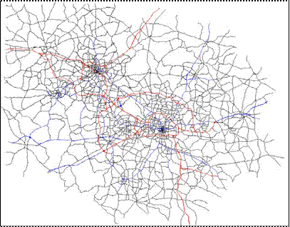
Figure 1. Schematic of the Triangle Regional Network
| # of Nodes | 180 | |
| # of Links | 445 | |
| # of OD demand Zones | 13 | |
| 1-hour | SOV (incl. passenger can and passenger truck) | 22804 |
| HOV (incl. passenger car and passenger truck) | 2291 | |
| Truck (incl. light commercial truck, single unit long-haul truck and combination long-haul truck | 1119 | |
Under Task 2, the micro-simulation test bed network was constructed in AIMSUN and calibrated using traffic volume data obtained from fixed sensors deployed by Traffic.com in the last reporting period. In this reporting period, validation of the network at the micro-level was continued using second-by-second vehicle activity data from empirical tests via a Portable Emissions Measurement System (PEMS). Based on the results of the validation, a list of simulation parameters pertaining to the car-following model used in AIMSUN was developed to refine the micro-scale vehicle activity. There has not been any change in goals and the work is proceeding in a manner consistent with the research plan as spelled out in the original proposal.
Task 2 also involves modifying the meso-scopic traffic simulation model to enable vehicle trajectory reconstruction. The research team compared real-world vehicle trajectory data from the NGSIM project with vehicle trajectory data generated using the proposed methodology to examine the accuracy of the vehicle trajectory data created by the meso-scopic traffic flow model. Our estimation results provide a reasonable match to the observed trajectory data, in particular for shock wave propagation and stop-and-go pattern representation. Overall, the reconstructed trajectories offer a more detailed representation, compared to macroscopic cell-based or link-based flow and density estimates.
For Task 3, we have continued to collect field data to augment the legacy database. The data collection plan includes a study route, choice of vehicles, choice of drivers, and selection of time of day and day of week for measurements.
For Task 4, we conducted field data collection between August 29, 2011 and February 26, 2012 on 27 light duty gasoline vehicles, ranging from 1.4 to 5.3 liter engines and with accumulated mileage ranging from 13,000 to 153,000 miles. In-use measurements of CO2, CO, hydrocarbons, and NO were made using a Portable Emissions Measurement System (PEMS). Vehicle activity was measured using an On-Board Diagnostic (OBD) data logger for the vehicle Electronic Control Unit (ECU) and a Global Positioning System (GPS) receiver for vehicle location and elevation.
As part of Task 5, we have completed the identification, characterization and selection of the traffic control measures to be applied to the meso/micro simulation models, in order to test their effectiveness on reducing the emission inventory on the road network. The findings of this task are summarized later in this document, and provide a roadmap to the set of simulation experiments to be carried out in the next reporting period.
For Task 6, we have continued development of a simplified vehicle emissions model that we refer to as “MOVES Lite.” This model is a simplified version of the U.S. EPA’s MOVES model for highway vehicle emissions. We have developed MOVES Lite to include five key vehicle types and to span vehicle ages from 0 to 30 years old. MOVES Lite currently is configured to estimate cycle average emission rates for any user-specified driving cycle for CO2, CO, Hydrocarbons (HC), and NOx. MOVES Lite has been evaluated by comparing its predictions to those of the MOVES model for the same cycles.
As a second element of Task 6, we have continued work to compare and evaluate the MOVES model itself versus real-world emissions data collected using PEMS. Notably, a recent presentation that we gave on the empirical evaluation of MOVES has been incorporated by EPA/OTAQ into its own review of the MOVES model.
As a third element of Task 6, a portion of MOVES Lite has been incorporated into a traffic simulation model, and we are in the process of verification of the accuracy of the incorporated model.
For Task 7, we have conducted preliminary sensitivity analyses.
Task 8 is mainly focused on demonstration of an integrated method for quantification of vehicle emissions as part of traffic simulation modeling. Thus, Task 8 will be a key focus in the upcoming year of the project. During the current year, the main focus related to Task 8 has been on demonstrating how the simplified “MOVES Lite” can be applied to estimate emissions for any arbitrary driving cycle. As an initial part of Task 8, a case study was performed to test the proposed multi-scenario, multi-resolution modeling/simulation methodology using a small subarea of the Salt Lake regional network. In this case, data were first imported from the regional travel demand model to create a network for use in DTALite. Field data were used to perform Origin-Destination Matrix Estimation (ODME) to better represent demand in the network. Several scenarios then were constructed to test the effects of different work zone schedules and variable message signs in different scenarios.
Journal Articles:
No journal articles submitted with this report: View all 34 publications for this projectSupplemental Keywords:
Air, Air Quality, air toxicsProgress and Final Reports:
Original AbstractThe perspectives, information and conclusions conveyed in research project abstracts, progress reports, final reports, journal abstracts and journal publications convey the viewpoints of the principal investigator and may not represent the views and policies of ORD and EPA. Conclusions drawn by the principal investigators have not been reviewed by the Agency.