Watershed Academy Web
8 Tools of Watershed Protection in Developing Areas
Watershed Academy Web
8 Tools of Watershed Protection in Developing Areas
Within the discipline of land use planning, a wide variety of techniques can be used to manage land use and impervious cover in subwatersheds:
Watershed-based Zoning: This technique is the foundation of a land use planning process using subwatershed boundaries as the basis for future land use decisions. Watershed based zoning involves defining existing watershed conditions, measuring current and potential future impervious cover, classifying subwatersheds based on the amount of future imperviousness, and most importantly modifying master plans and zoning to shift the locations and density of future development to the appropriate subwatershed management categories. A watershed based zoning approach should include the following nine steps:
Overlay Zoning: This land use management technique consists of superimposing additional regulatory standards, specifying permitted uses that are otherwise restricted, or applying specific development criteria onto existing zoning provisions. Overlay zones are mapped districts that place special restrictions or specific development criteria without changing the base zoning. As shown in the maps at left, overlay zones can also be created to protect wetlands, forests, historic sites, or even barrier islands and their surrounding resources. The advantage of overlay zones is that specific criteria can be applied to isolated areas and overlay districts are not necessarily restricted by the limits of the underlying base zoning. An overlay zone may take up only part of an underlying zone or may even encompass several underlying zones. Often, the utilization of an overlay zone is optional.
Impervious Overlay Zoning: This specific type of overlay zoning limits future impervious area by estimating the environmental impacts of future impervious cover and setting a limit on the maximum imperviousness within a given planning area. Site development proposals are then reviewed in the context of an imperviousness cap. Subdivision layout options must then conform to the total impervious limit of the planning area.
Performance Zoning: This technique is designed to ensure an acceptable level of performance within a given zoning district such as providing a certain open space ratio, an impervious area target, or a desirable density. Performance zoning is a flexible approach that has been employed in a variety of fashions in several different communities across the country. Some performance factors include: traffic or noise generation limits, lighting requirements, stormwater runoff quality and quantity criteria, protection of wildlife and vegetation, and even architectural style criteria.
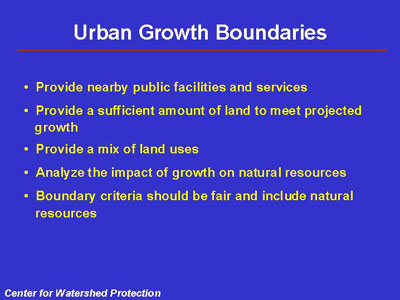
Urban Growth Boundaries: This planning technique establishes a dividing line between areas appropriate for urban and suburban development, and areas appropriate for agriculture, rural and resource protection. Boundaries are typically set up for a 10 or 20 year period and should be maintained for the duration of the life of the planning period. Boundaries may be examined at planning period renewal intervals to assess whether conditions have changed between planning cycles to ensure a consistent playing field for both the marketplace and citizens.
Urban growth boundaries are sometimes called development service districts, and include areas where public service is already provided (e.g. sewer, water, roads, police, fire, and schools). The delineation of the boundary is crucial. Listed in the accompanying figure are several important issues to consider in establishing an urban growth boundary.
Large Lot Zoning: This land use planning technique is perhaps most widely used to try to mitigate the impacts of development on water quality. The technique involves zoning development at very low densities to disperse impervious cover over very large areas. Densities of 1 lot per 2, 5, or even 10 acres are not uncommon. From the standpoint of watershed protection, large lot zoning is most effective when lots are extremely large (2 to 20 acre lots). While large lot zoning does tend to reduce the impervious cover and therefore the amount of stormwater runoff at a particular location, it also spreads development over vast areas. The road networks required to connect these large lots can actually increase the total amount of imperviousness created for each dwelling unit. In addition, large lot zoning contributes to regional sprawl. Sprawl-like development increases the expense of providing community services such a fire protection, water and sewer systems, and school transportation. Sprawl also increases the amount of land converted from forest or farmland to lawns.
Infill/Community Redevelopment: Infill development encourages new development in unused or underutilized land in existing urban areas. Community redevelopment is a planning initiative to foster revitalization of existing neighborhoods by redeveloping existing buildings and properties that are severely blighted or damaged. Infill and redevelopment can be employed in either large or small projects. Some of the existing impediments to more widespread implementation of these types of projects include: the existing condition of a potential redevelopment site in terms of environmental constraints, the restrictive nature of many land use regulations, and pressing social and economic issues.
Transfer of Development Rights (TDRs): This land use management technique can support local comprehensive planning goals and facilitate Watershed Based Zoning proposals by transferring development potential from sensitive subwatersheds to subwatersheds designated for growth. The principle of TDRs puts to creative use the premise that ownership of land entails certain property rights and therefore individual rights can be bought and sold to accomplish various community planning objectives.
Other zoning categories include floating zones and incentive zones.