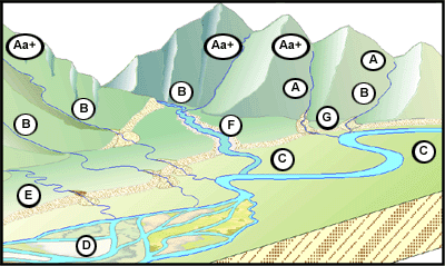
The figure at left shows how different Level I stream types tend to appear in different parts of the landscape. With proper training, Level I classification can be delineated on common information sources such as topographic maps and aerial photographs.
For a summary of the typical features and measurements associated with each Level I stream type, look at the Table of Level I stream type characteristics. Table of Level I stream type characteristics (PDF, 45K, About PDF).